|
tazonne
RO FORUM OWNER
Din: CRIPTA
Inregistrat: acum 18 ani
Postari: 220
|
|
NASA World Wind 1.3.5 Full | 60 MB
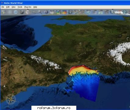
NASA World Wind - Most detailed globe, which only can be found. Our planet (and not only ours, but more on that below), appears before us in full 3D, meaning that it can rotate, zoom and delete as you like.
If you zoom the camera, then the Internet will load more detailed surface texture, as if down to a bird's-eye view - photo (by satellite), the place where the camera points. Unfortunately, detailed images of the Earth is not so much as we would like.
In addition to our own planet, you can walk on the Moon and Mars. There is a search engine (towns, streets and even houses), and the political map of the Earth, as well as a pile of filter mappings for the three celestial bodies.
NASA World Wind - the program allows to observe three-dimensional images of the Earth and Moon derived from the satellite and perform a virtual search. Program of NASA World Wind, unlike Google Earth, not only to behold pozvolyayuet 3D surface of the Earth, but also to examine the surface of its natural satellite - moon.
Initially, the program NASA World Wind, as well as Google Earth, was developed for visualization of terrestrial spatial data. The entire Earth captured with a resolution of 15 meters per pixel, while the U.S. - 1 meter / pixel, a densely populated area - 0,33 m / pixel. To get to anywhere on the planet, there is search, which simply type the interesting object, either a city or any town. Likewise, similar to Google Earth, search for, a picture of the world starts to rotate and zoom the object prorisovyvaya him as the extent possible. Zoom function is implemented in the World Wind as a change in height, which looks on the surface of the camera. With a height of the image looks flat, but with a height of several tens of kilometers in the mountains is clearly visible impact prospects and smooth scrolling image creates an impression of flying over the real terrain. In addition to pictures of Earth, the program also shows the surface of the Moon. The images obtained by satellite "Clementine", launched in 1994 and has made over this period about 1.8 million images. NASA World Wind allows you to observe the moon in nearly any point to it, adjusting the approximation of the image. The picture is clearly visible relief of natural satellites, mountains, craters and chimneys. Some images are so detailed, which gives the ability to customize the type of the lunar surface with twenty meters. In addition to this program, you can view statistical data on earthquakes, typhoons, wind, tsunamis and other natural phenomena. NASA World Wind will be interesting to use in
Code:
27.8KB
_______________________________________

|
|
| pus acum 17 ani |
|